+256 789700447 | +256 751807085
info@weismannexpeditions.com
ABOUT RWENZORI MOUNTAIN NATIONAL PARK.
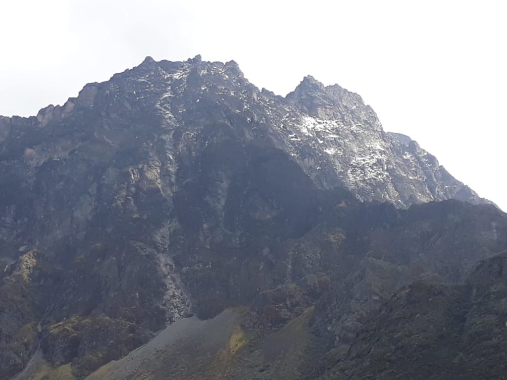
The Rwenzori Mountains National Park covers nearly 100,000 ha in western Uganda and comprises the main part of the Rwenzori mountain chain, which includes Africa’s third highest peak (Mount Margherita: 5,109 m). The Rwenzori Mountains have been called the “Mountains of the Moon” and are believed to be the ones described by the 2nd Century AD geographer Ptolemy and were long thought to be the source of the Nile.
They form a range of 100 km long and 50 km wide. On the Mount Stanley Glacier there are six mountains and this glacier is used to get access to the range. region’s glaciers, waterfalls and lakes make it one of Africa’s most beautiful alpine areas. The park has many natural habitats of endangered species and a rich and unusual flora comprising, among other species, the giant heather.
The Rwenzori Mountains National Park provides stunning views of glacier and snow-capped mountains just a kilometer from the equator, where it is contiguous with the Virunga National Park in the Democratic Republic of Congo (DRC). Having the third highest mountain in Africa at 5,109 m (after Kilimanjaro and Mount Kenya), the Park includes a much larger alpine area than either, covering an area of 99,600 ha of which 70% lies at over 2,500 m in height. The Rwenzori Mountains are the highest and most permanent sources of the River Nile, and constitute a vital water catchment. Their multitude of fast flowing rivers, magnificent waterfalls and stratified vegetation make the property exceptionally scenic and beautiful. The mountains are well-known for their unique alpine flora which includes many species endemic to the Albertine Rift in the higher altitude zones including giant heathers, groundsels and lobelias. The Park also supplies local communities with various wild resources and is an important cultural heritage.
The Rwenzoris are the legendary “Mountains of the moon”, a reflection of the mist-shrouded mountains of this rugged massif that tower almost 4,000 m above the Albertine Rift Valley, making them visible from great distances. These mountains offer a unique and pristine landscape of alpine vegetation studded with charismatic giant lobelias, groundsels, and heathers which have been called “Africa’s botanical big game”. The combination of spectacular snow-capped peaks, glaciers, V-shaped valleys, fast flowing rivers with magnificent waterfalls, clear blue lakes and unique flora contributes to the area’s exceptional natural beauty.
The region is known to be among those experiencing stability in the region and this has given us the opportunity to offer this seldom visited and very remote mountain range as a great trekking and climbing option
Drive from Kampala in the morning and proceed to the western part of the country by either passing through Masaka-Mbarara which is 422km drive by 4*4 vehicle that takes you through Queen Elizabeth national park crossing the Equator line that takes 7-8 hours and arrive in Kasese town or by using Mityana-Fortportal kasese road which is 372km drive that takes 6-7 hour drive to Kasese. On reaching either Mbarara or Fortportal, your driver will stop you for a lunch and then proceed to kasese and to your hotel for an overnight
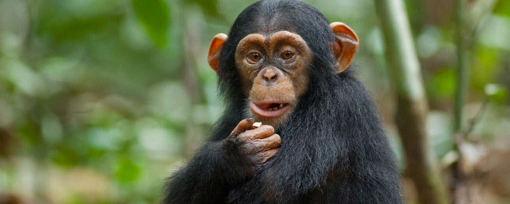
In the morning after breakfast, you will be picked by your guide and then head to the Rwenzori Mountains National Park Head Quarter at Nyakalengija, 1.646 m. At this point you receive briefing from your guide or the tourism officer. The hike starts through the plantations and homes of the Bakonzo, the people of the mountain, gradually reaching garden plots and elephants grass and then join the forest zone . You follow the Mubuku river, until crossing the Mahoma river. The trail passes through an open bracken fern slopes and a beautiful Forest canopy, up to Nyabitaba Hut, 2.652 m. which is the arrival point for the day. From the location, you are facing on the North the Portal Peaks 4.627m, in front Mount Kinyangoma. During the day, you might see monkeys, the Rwenzori Turaco, three horned chameleons which is endemic in the Rwenzoris, common bulbul birds, yellow eyed tinkle birds, wood pecker, mountain elephants and hearing the voices of the chimpanzee, Kasese town. This hike takes between 5-6 hours
From Nyabitaba Hut you cross the Kurt Shaffer Bridge, through a muddy area. Then the trail climbs up through the bamboo forest. During this day, it takes you to the forest zone up to Kurt Shaffer bridge and then you start the bamboo/memolopsis zone up to Nyamuleju camp which is the old hut before John Maate camp. This point marks the start of the heather zone where you will see the Ericaceous trees, everlasting flowers, giant lobelia and groundsel and its at this point where you can see red duikers, rock hyrax and white Columbus monkeys. The way proceeds through a bog full of typical plants along the Bujuku River. The final point is John Matte Hut, 3.414 m. for spending the night. From Nyabitaba Hut to John Matte it can take approximately 6-7 hours. Enjoy the view of Mount Stanley and snow capped Margherita and Elena Peaks if the weather is clear.
From John Matte Hut you cross the Bujuku River and enter the lower Bigo bog, a grassy bog where you experience how to jump from tussock to tussock. Currently, there is a constructed walk board on both lower and upper bigo bogs that makes a clear view of the mountain sceneries. And this is the point where you start the alpine savannah zone of little vegetation
During this day you will be able to see the beautiful gardens of giant lobelia, asanasio black berries, wild carrots, Alcamilla, lake Bujuku, sun birds, red duikers, rock hyrax and more.
Depending on the weather, you may be able to view the peaks of Mount Stanley, Mount Baker and Mount Speke. You finally arrive at Bujuku Hut, 3.962 m. From Bujuku, here starts the diversion for whom intends to climb Mount Speke. For those climbing Margherita and Alexandra peaks it is advised to proceed to Elena Hut for overnight. This day hike takes between 4-5 hours.
After early morning breakfast ascent to Mount Speke up to Victoria Emanuel Peak (4.890 meters). This is a trail at a high altitude, with some points a bit exposed with rocks and grass, which often require the use of hands. Particularly, there are a couple of points where a lot of attention is needed that are clearly know by our expert guides. The glacier on covers the smallest area which the require the use of crampons, ice axe, rope and the hynes. In case of rain, to be on a safe side and during the descent it is advisable to use the rope. On reaching the top during clear weather, you are able to enjoy the beautiful view of Bujuku valley, Margherita peak, Baker, Alexandria and Baker. Take enough photos and then return back to Bujuku hut for lunch and then an overnight. This can take you 7-8hours
From Bujuku, the trail takes you through more bog, while climbing the steep slopes west of the lake and through the magical Groundsel Gully as it ascends to Scott-Elliot Pass at 4372m. At the head of the gully a metal ladder takes you over a steep section after which the trail is divided into two. The trail on your right leads up to Elena Hut and Mount Stanley on a steep trail over large boulders, while the trail on your left leads to Scott-Elliot Pass and down to Kitandara Lakes. During this day, you be able to see Mount Speke glacier on Victoria Emmanuel, Margerita peak on Mount Stanly and the nice view of Lake Bujuku, amazing rock path and so many others. Finally you will reach for an overnight at the Coolly & Icy Elena Hut. This day hike takes between 4-5 hours.
For those aiming at reaching Margherita peak (5109m), continue to the base of the Stanley Glacier. To reach the summit of Margherita, the climb takes about 5-7 hours depending on the weather conditions and the pace of climbing this mountain. This tough walk takes you over three glaciers, slippery rock, ice and very exposed areas which are open on many sides. Note that this climb is for only physically fit and technical climbers. Climbing on to the glaciers, cross the Stanley Plateau and proceed with the ascent. Acclimatized to fog, altitude sickness and coolly weather, scramble up to the summit of Margherita the highest peak of the Rwenzoris
Given the high altitude and the tough conditions even if you do not reach the peak, don’t get disappointed.
Reaching back to Elena hut, prepare for sloping down to Kitandara hut through Scott-Elliot pass, where there are spectacular views back to Bujuku Lake and Mount Speke, up to Mount Stanley and down to the Kitandara Lakes. After the trail that passes you through an alpine zone of sparse vegetation with beautiful gardens of flowering Asanasios, giant lobelias, and rough boulders, descend to the twins Lakes of Kitandara where you will enjoy the shores of Kitandara Lake which is worthy beach life and overnight at the Kitandara Hut. This also takes you to 2-3hours but ascending down throughout the hut. However, basing on the time reached at Elena hut after margarita, you talk with your guide to have another night at Elena hut which will lead to an extra day
Start early morning the journey to Weismann peak 4620m passing along the shores of lake Kitandara on a flat area and then hike steeply towards Bigata lake and then to the peak. Reaching on top during clear view, you are able to see all the major peaks of Mt Stanly, Mt Speke and Mt Baker. This takes between 4-5 hours. . This is a non technical peak. Take enough photos and then ascend back to Kitandara hut for Lunch have lunch and have enough rest while acclimatizing for mount Baker
Set off earning after morning breakfast to climb the Mt Baker Peak 4,842M. Ascent time from Kitandara hut takes 3-4 hours and descent 2-3 hours. This is a steep rocky climb where you need a good head light for morning lighting as some sections like the crevice climbing up to Freshfield pass. Although steep Mt Baker is considered non-technical except in the snow season (wet season) of April-May and September-October when it is very slippery on the ice covered rocks, nevertheless safety ropes will be used at all times on steep sections. After climbing up you descend along a crack in the rock face to the glacier and a short 300m walk to the peak. During clear weather or a break in the cloud, the views of the main peaks of Margherita, Alexandria, Stanley’s plateau and the glaciers are fascinating as you see the splendor of these beautiful snow-capped mountains. After absorbing this lifetime experience we walk back across the glacier climb back up the crack in the rock face and descend to Kitandara hut for lunch and overnight. However, other clients opt to continue to Guy Yeoman depending on the client’s fitness.
From Kitandara, take on the trail that ascends steeply up the headwall, spreading out from the base of Mount Baker and continuing along the south side of the mountain to Fresh field Pass 4.282 m. At this point you can view into the Congo to the west and Mount Stanley to the north. From the pass, take on the long trail passing through bogy and slippery rocks that leads you to Bujongolo rock shelter the base camp for the historic expedition by the Duke of Abruzzi in 1906. The hut is surrounded by a beautiful landscape of mountains, vegetations dominated by the giant lobelias and rivers. Overnight at Guy yeoman and this takes 5-6 hours
In this day you complete the central circuit by going back to Nyabitaba Hut. The trial is attractive along the valley of the Mubuku and Kichuchu rivers, rich in plants and flowers of the heather zone before reaching the bamboo forest. Time to reach Nyabitaba is about 4- 5 hours. Eventually, you decide to descend directly to Nyakalengija, adding 2-3 more hours or stay at Nyabitaba hut for an overnight. Here it may depend on the decision of the client to either make it a one way journey from Guy Yeoman Hut direct to Nyakalengija or to have an overnight at Nyabitaba. However most clients prefer to make it one way journey from Guy Yeoman Hut direct to Nyakalengija/Park Head Quarter. Picked by your driver to Kasese town for an overnight
In the morning, take breakfast and drive to Kampala either through Kasese-Fortportal road (372km) or Mbarara-Masaka road (422km) to reach Kampala /Entebbe for a flight back home.